DC's (lack of full) commitment to bicycle "superhighways": and the counter example of Four Mile Run Trail in Arlington County
In order to increase significantly the take up of bicycling for transportation, appropriate infrastructure needs to be provided. Just as for the traditional road network and its classification of freeways, highways, principal and secondary arterials, collector streets, and neighborhood streets serving a variety of types of trips, what's appropriate bicycle infrastructure depends on the nature of the trip, such as if it is intra-neighborhood, within a district or city, or a further distance, across jurisdictional boundaries, etc.
I wrote about this a couple months ago, in "Wanted: a metropolitan scale bikeways/trails program run by the Metropolitan Planning Organization," which was in part a response to the area Paved Trails Plan draft by the National Park Service. There was a brief follow up based on the trail signage framework developed in Greater Knoxville ("Greater Knoxville Greenway signage framework").
My complaint is that there isn't a metropolitan-scale plan for the Washington metropolitan area, laying out and implementing an integrated system of bikeways that is cross-jurisdictional.
This is the case despite planning within jurisdictions such as in DC, Prince George's County, and Montgomery County, the latter two are updating the bicycle and trails plans.
At the metropolitan scale, there are many gaps in planning and practice when it comes to the build out of the equivalent of cycle superhighways comparable to the Dutch ("The – almost finished – F59 from ʼs-Hertogenbosch to Oss," Bicycle Dutch), Danish ("In Denmark, Pedaling to Work on a Superhighway," New York Times, German ("Moving Beyond the Autobahn: Germany’s New Bike Highways," Yale360), or London ("The new East - West Cycle Superhighway in London, Hackney Cyclist).
Cycle superhighways are long distance trails many miles in length, with high quality treatments, including for the most part, separation from motor vehicle traffic and highly distinctive treatments at junction points between the road network and the trail network.

From the Yale360 article:
Cycling highways are fundamentally different from usual cycling lanes. Highways are around 4 to 5 meters wide — twice the width of many bike paths — so faster cyclists can overtake slower ones in both directions. High-quality asphalt is often used to enable bicyclists to travel faster. These highways are designed with few or no intersections with major roads, and as few traffic lights as possible — all intended to enable cyclists to travel effortlessly within or among cities and suburbs. Like autobahns, the biking highways are designed to allow travelers to cover large distances without leaving the network.DC's primary cycle superhighways are the Anacostia Riverwalk Trail, the Capital Crescent Trail, and the Metropolitan Branch Branch Trail, and the Suitland Parkway Trail, among others. These trails do have long stretches of lanes separated from motor vehicle traffic.
Still, there are many gaps and it is taking more than 30 years to realize the Metropolitan Branch Trail, from when it was first suggested in an op-ed in the Washington Post in 1989 ("Geared to Everyone's Interests-A Brookland Bike Trail").
The primary cycle superhighway in Metropolitan DC is the Mount Vernon Trail in Northern Virginia, which is mostly on property controlled by the National Park Service. This trail is accessible from highway crossings and includes connections to National Airport, both of which are still relatively extraordinary examples of high quality connections within a bikeway network.
The Mount Vernon Trail is complemented by other trails in Northern Virginia, including Four Mile Run, Custis Trail, both in Arlington County, and the multi-county Washington and Old Dominion Trail.
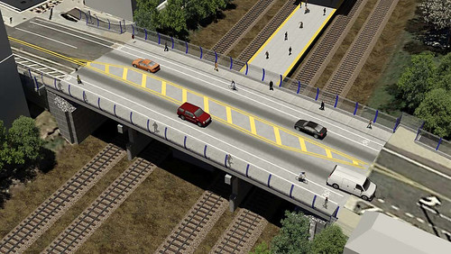
In their latest advocacy e-letter, Washington Area Bicyclist Association recounts how the DC Department of Transportation will not be including an underpass for the MBT at Monroe Street NE in conjunction with the reconstruction of that bridge, even though this had been promised for many years.
Note that I wrote about different failure wrt this project in June, about how the reconstruction could be leveraged to reknit the street fabric between the east and west sides of the Brookland neighborhood by constructing liner buildings on Monroe Street. See "Transportation infrastructure and civic architecture #4:The Monroe Street Bridge as an opportunity to reknit the built environment/street fabric."
In 2012, I suggested an alternative routing for the MBT in this area on 9th Street NE, because the 8th Street routing mixes cyclists with industrial and school traffic. See "Alternative routing for the Metropolitan Branch Trail in Brookland." (Note that photos in the entry with an unviewable notice are viewable if you click through.)
I think DDOT's move forward with a bridge reconstruction not including either liner buildings or an underpass for the Metropolitan Branch Trail are good examples of how DDOT isn't fully committed to how transportation infrastructure projects can make long term positive contributions to community and economic development and a more integrated multi-modal transportation system that is focused on optimal mobility in the urban context.
However, there's no doubt the city is committed to cycling.
DC is doing a lot of good, commendable actions, such as expanding bike share, creating cycle tracks, creating contra-flow lanes for bicyclists so that they can ride legally in both directions on one way streets ("G Place NE contraflow lane - Now with markings!," WaschCycle), developing a "neighborhood bikeway network" and improving cyclist safety at problematic intersections by creating new marking patterns on the street ("These new bike lanes help traffic flow, called "pocket lanes," help traffic flow and keep cyclists safe," Greater Greater Washington).
But at the same time, the agency seems to be unwilling to develop projects in particularly transformational ways, such as making the MBT work well as a "cycle superhighway" by building an underpass at Monroe Street, or developing the bridge so that it can accommodate liner buildings.
I contrast this to Arlington County, Virginia -- granted they developed a set of "cycle superhighways" over many years.
Earlier in the week, I had a meeting in Alexandria, at a location near the conjunction of Alexandria, Arlington, and Fairfax Counties, just off King Street. It was about 14 miles from home and I cycled despite the heat.
About half the trip was in DC, all on streets, and the rest in Virginia.
Once I got to the 14th Street Bridge I was able to ride almost the entire remaining distance without coming into contact with motor vehicle traffic, via the Mount Vernon Trail and the Four Mile Run Trail, having had to cross only a handful of streets. Four Mile Run is particularly exemplary, with a number of underpasses, the kind that DDOT is not willing to build at the Monroe Street Bridge. It even provides an underpass crossing of I-395, the Interstate Highway!
It could have somewhat better signage, although the signage is quite good, and it lacks map signs, air pumps, repair stands, etc. (There is one map sign on the Mount Vernon Trail when it intersects.)
While it doesn't have those particular amenities, it does have some covered benches, trash cans, public art, a bike share station and exercise stations adjacent to the trail in Shirlington, and a community bulletin board in the Claremont neighborhood.
A metropolitan bikeways plan would call out exemplary infrastructure and set high expectations for adopting the same kind of infrastructure across area jurisdictions with the aim of creating an integrated wide scale bikeways network.
On underpasses
Arlington County -- +1
DC -- -1 (although the Metropolitan Branch Trail has an overpass at Rhode Island Avenue and Florida Avenue and an underpass at New York Avenue).
Public art on the fence outside the wastewater treatment plant

Trail rules sign

Community bulletin board, Claremont Historic District

Bike share station map, S. Arlington Mill Drive, Shirlington

Street underpass on the Four Mile Run Trail

Underpass at I-395, Flickriver photo

The Four Mile Run Trail is also an electric power transmission corridor

Transportation brochure rack, Shirlington Library

Area transportation options map, Shirlington Library


On S. Walter Reed Drive near King Street/Alexandria City border

Labels: bicycle and pedestrian planning, parks planning, sustainable mobility platform, urban design/placemaking
posted by Richard Layman @ 5:19 PM&Permanent Link
![]()
![]()


1 Comments:
Cycle smart coaching Service in NZ provides a fully customized cycling fitness coaching service for all the beginners and intermediate level. We offer complete support in order to achieve their personal and fitness goals.
Post a Comment
<< Home